There are two public walking tracks into Bushrangers Bay that are about the same length. One track starts north-east of the bay at Boneo Road and the other track begins at the Cape Schanck lighthouse carpark, west of the bay.
We chose to walk the track from the Cape Schanck lighthouse carpark because it’s arguably more scenic and there’s a lot more carpark spaces available.
Along the sandy track there’s a couple of opportunities to look back along the coastline towards Pulpit Rock.
Further along the track the native trees enclose the path and form a welcoming tunnel.
After a bit of walking the bush track crosses the Burrabong Creek via a small wooden footbridge. Eventually the bush track opens onto the sandy beach of Bushrangers Bay. Here you’ll encounter Main Creek which cuts through the sandy beach and enters the ocean.
You need to cross the creek. You might get wet feet here depending on how much water is flowing in the creek at the time, and how far you can jump. 🙂
In the photo below, Main Creek cuts through the sandy beach on it’s way to the ocean.
After crossing the creek it’s a short walk to the beautiful rock formations and platforms where at low tide there are lots of small crystal clear rock pools exposed.
At the water’s edge the rock platforms rumble as waves slam into the steep rocky walls.
Looking back from the arch towards Bushrangers Bay, lots of people exploring the platforms and rockpools.
It was a public holiday and very busy.
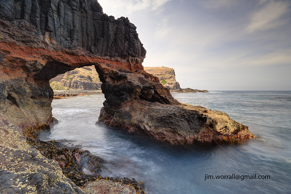
When we arrived at the arch we found that much of it was in the shade with very bright background elements.
This is problematic from a photography perspective, but anyway you work with what you’re given. 🙂
Photo below – Using a nice wide lens, some ND filtering, and blending 3 exposures I ended up with a keeper that I like.
This image is available to purchase as a print here.
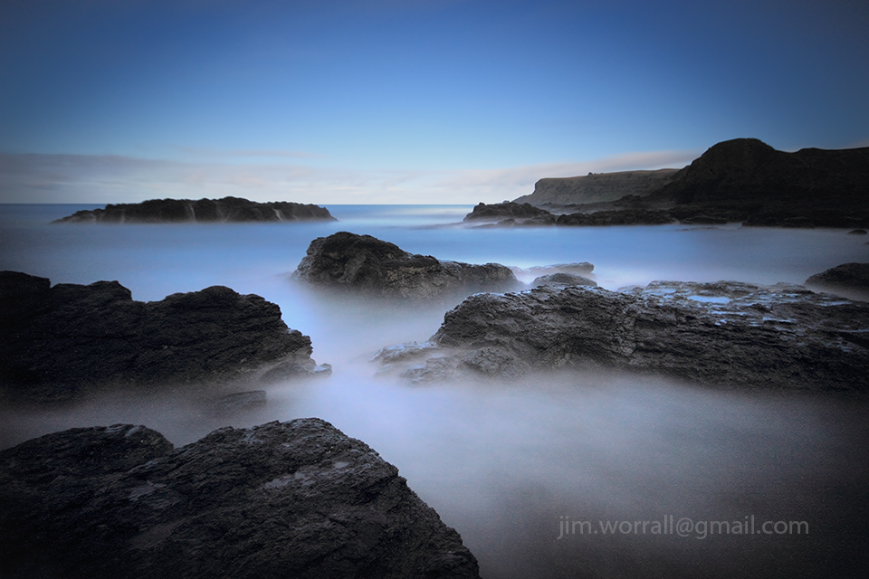
A long exposure image from Pearses Beach in Blairgowrie on the Mornington Peninsula. You can get to Pearses Beach by parking in the carpark at the southern end of Pearse Road in Blairgowrie, and walk a short distance along the sandy walking path to the beach.
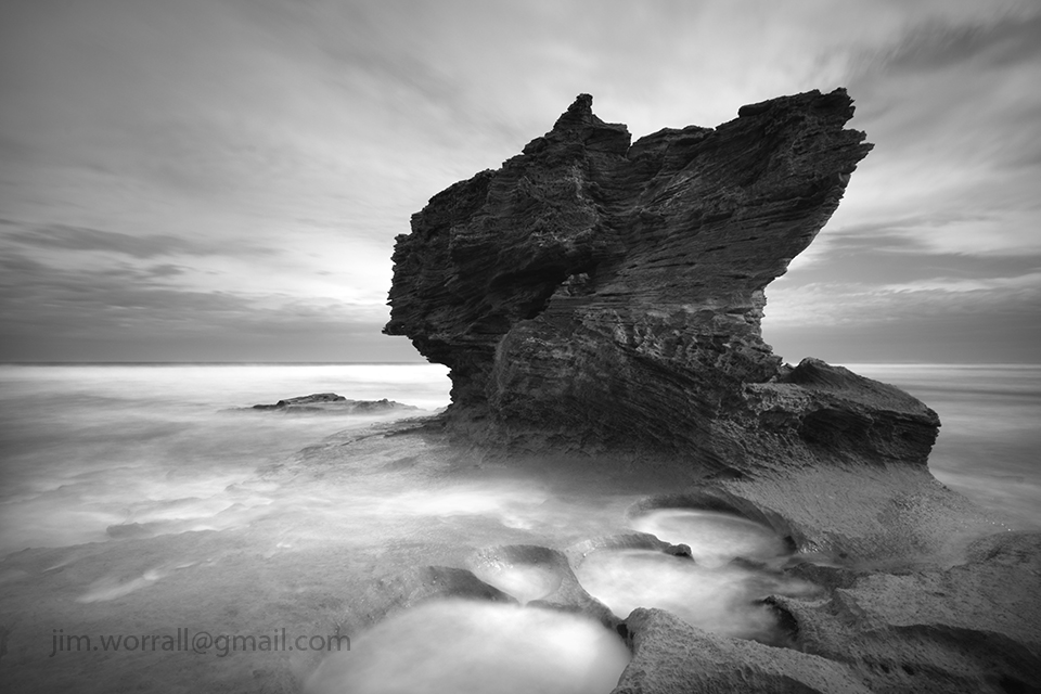
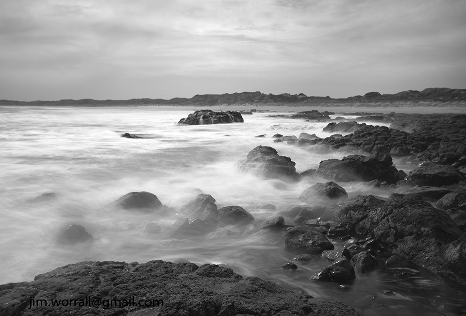
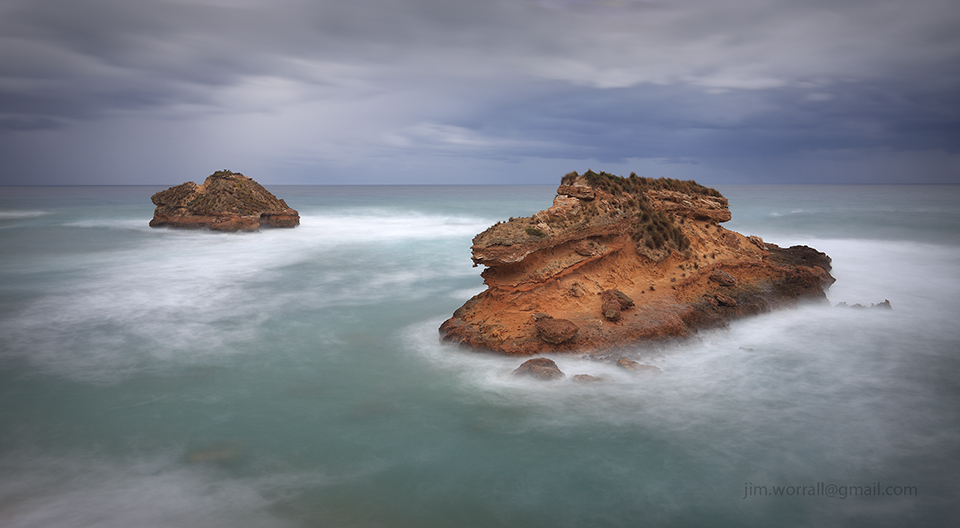
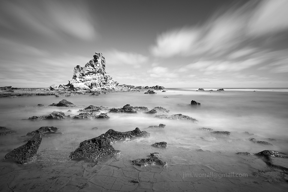
A long exposure image from Bridgewater Bay, Blairgowrie, on the Mornington Peninsula.
This photo was taken in harsh daylight conditions, so I opted for a black and white conversion of this one as the prevailing daytime colours added nothing substantial to the image.
Tech stuff – 5 sec, f/13, ISO50, ND500 filter.
As an interesting aside to the image above, if you look carefully you can see two blurry figures on the cliff near top left of frame. The local kids like to jump from this cliff into a rock pool below. Great fun for the brave ones! 🙂
Here’s a zoomed-in view below.
To get to Bridgewater Bay, go to the carpark at the end of St Johns Wood Road, Blairgowrie and follow the sandy walking track south. The best time to visit is at low tide. At high tide all of the rock platforms are submerged and pretty much inaccessible.
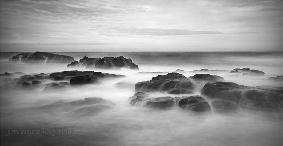
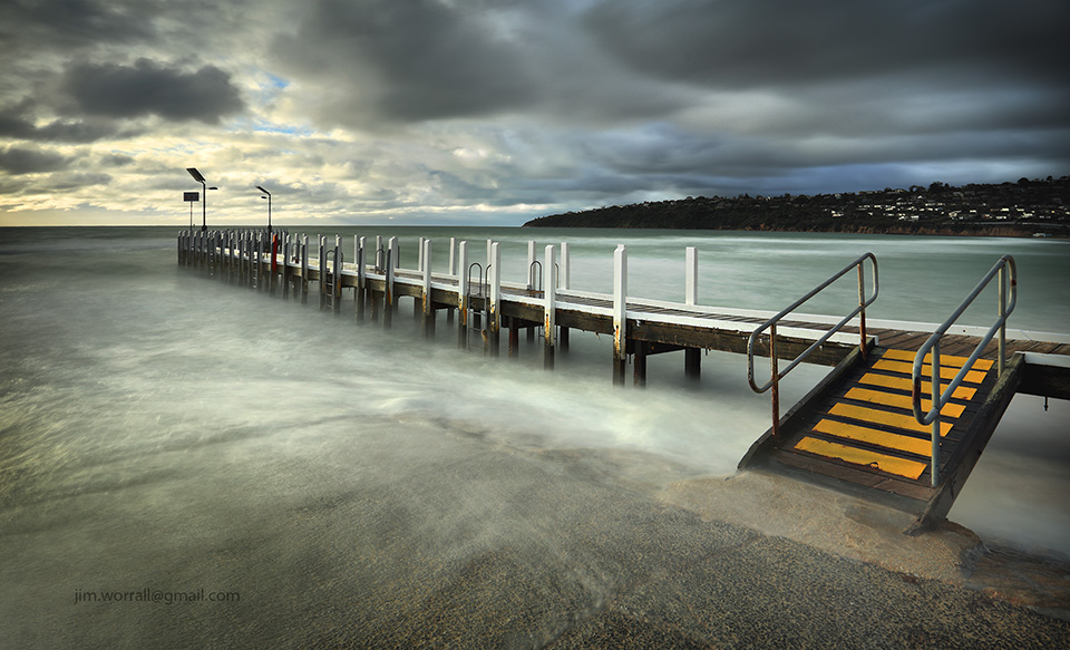
Following are a couple of long exposure images from Montforts Beach taken at first light on a cloudy grey dawn. You can access Montforts Beach by parking at the Spray Point Road carpark and following the sandy walking track south. Montforts Beach is signposted along the track. It’s also well worthwhile visiting Spray Point while you’re here.
Tech stuff for the image below- 5 sec, f/11, ISO50.
Technical stuff for the image below – 2.5 secs, f/18, ISO50.
The French Island to Corinella Barge traverses a narrow section of Western Port Bay carrying vehicles and passengers back and forth between the island and mainland.
Pictured below is a long exposure image of the Corinella Barge landing area as sunset approaches.
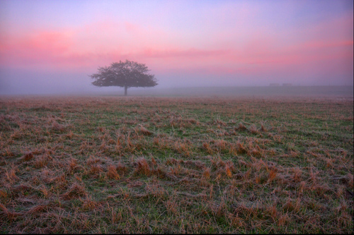
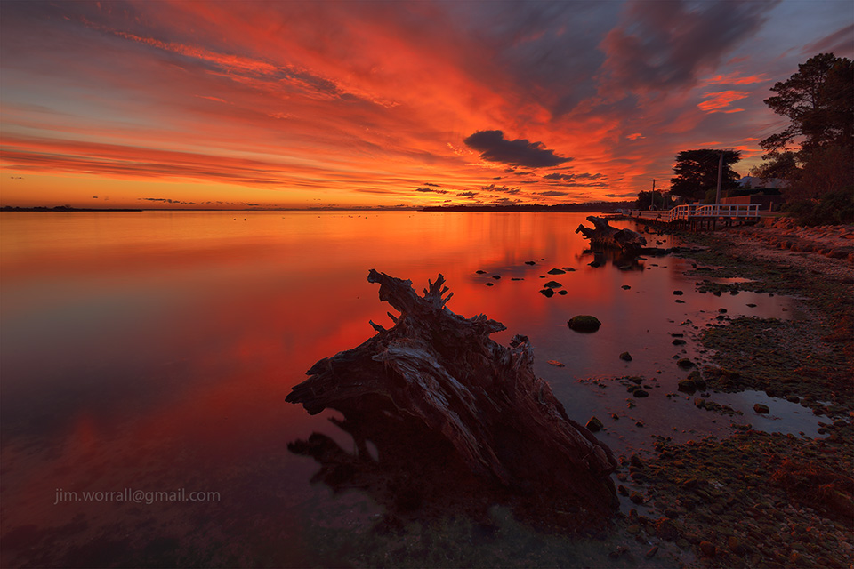
During a recent trip to Gippsland I was fortunate to be in the right place at the right time and experience an awesome sunset on the shoreline at Metung.
It was one of those rare occasions where the colour seemed to stay in the sky for ages. It was truly a magical evening. 🙂
Pictured below, one of the iconic tree remnants on the Metung shoreline, side lit by the setting sun.
.
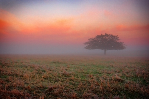
Pictured below, …Metung’s equivalent of the Loch Ness Monster, …..or perhaps it’s simply a tree remnant? 🙂
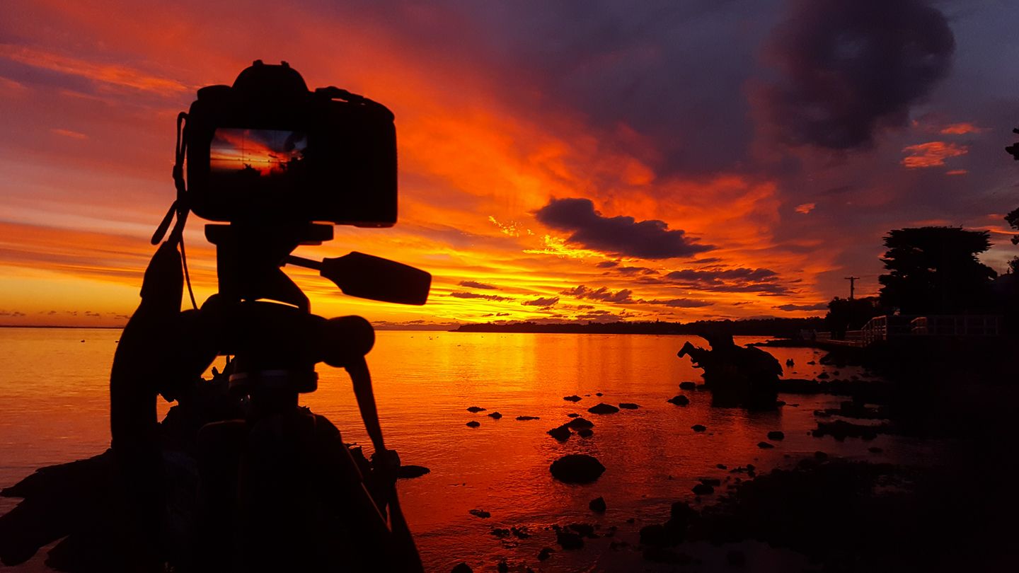
Pictured below, a “behind the scenes shot” caught with my phone camera as the sky lit up.
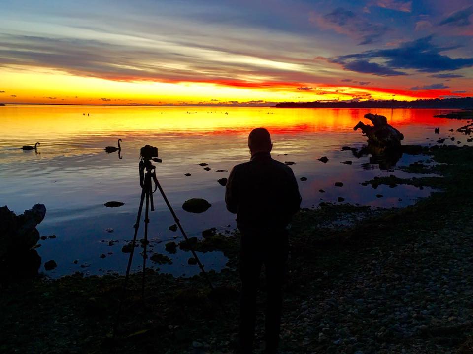
Pictured below, a “behind the scenes shot” taken as the sky started to fill with colour. Photo courtesy of Mustang Sally.
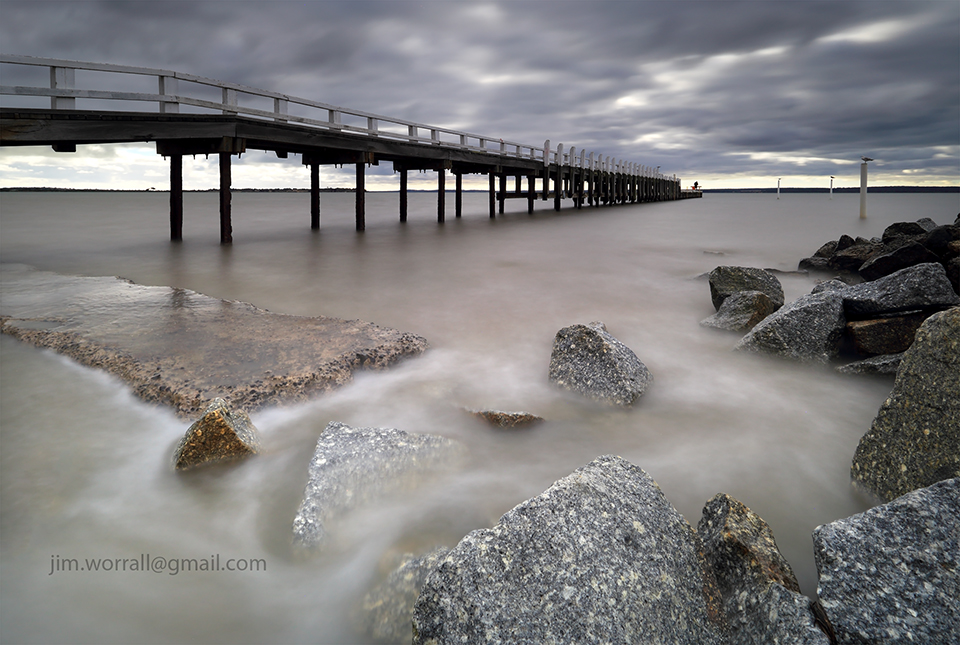
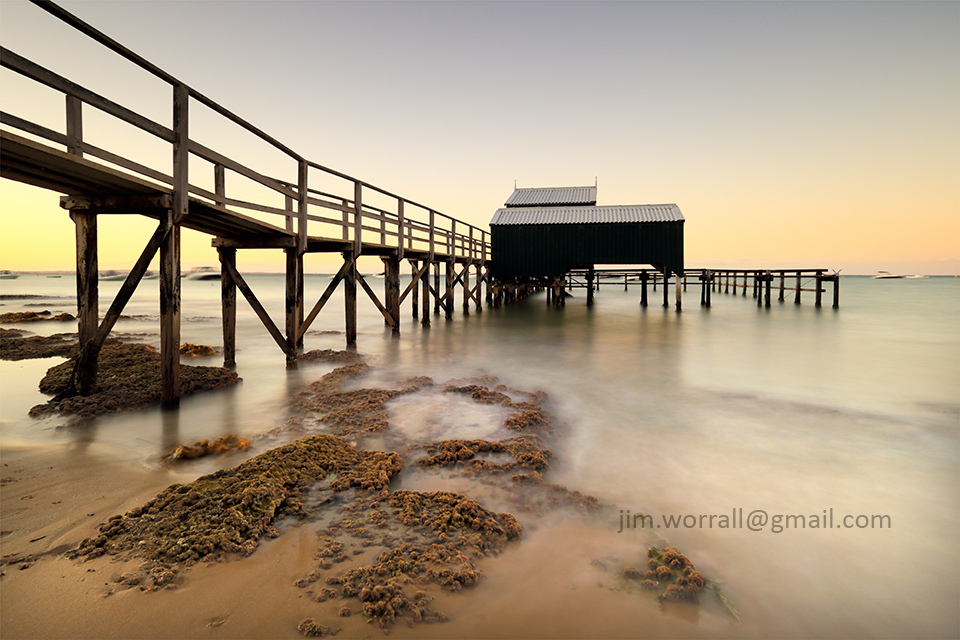
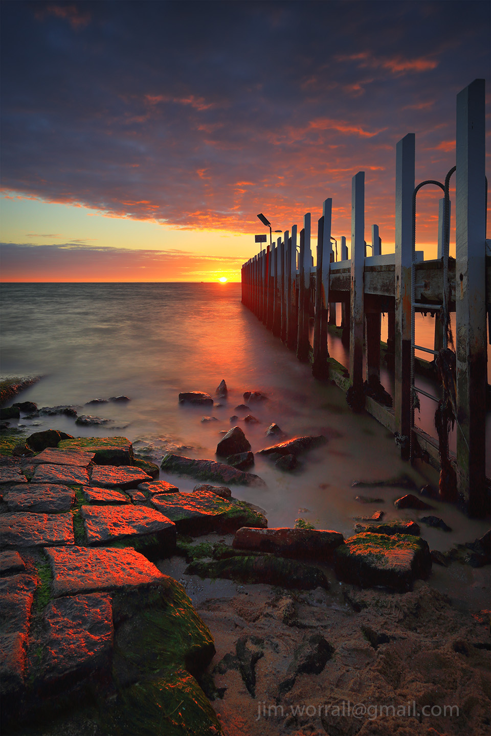
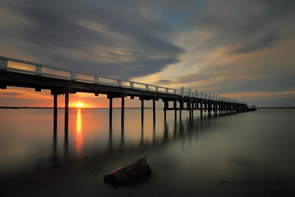
Following the destruction and subsequent rebuilding of this iconic jetty at Sullivan Bay, it took a few visits here for me to catch it in favourable light.
This is a long exposure of 204 seconds on a cloudy day giving nice diffused light.
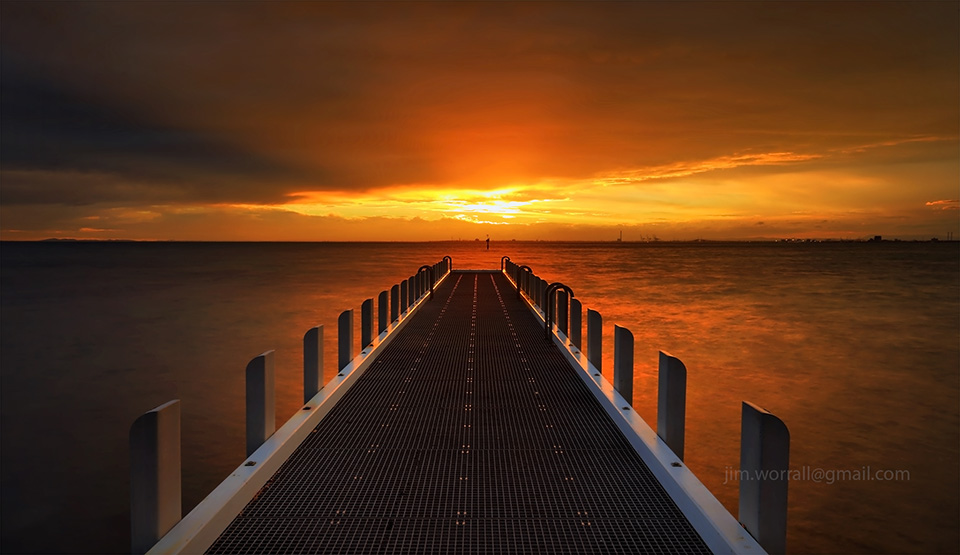
Last weekend we visited the new jetty at Olivers Hill in Frankston on the Mornington Peninsula. As the sun dropped down towards the horizon the sky exploded in a way that we really didn’t expect. It seems that predicting a colourful sunset in Melbourne is a bit like predicting the outcome of a coin toss. 🙂 These are short exposure shots using my phone camera as I left the “big boy”at home.
In the image above, the glowing red “eyes” and silhouette of a small drone can be seen hovering near the top edge towards the left of frame. The constant buzzing noise from these little buggers can ruin an otherwise tranquil atmosphere, …but hopefully the owner captured some great scenes from up there. 🙂
Grantville is a small coastal town on the east coast of Western Port bay in Victoria, Australia. The jetty at Grantville usually stands in relatively shallow water at high tide, and at low tide it stands proud on a bed of mud. During a “king tide” the water can sometimes cover the walking platform at the end of the jetty as seen here.
Following are a couple of long exposure images taken at sunset during high tide.
Tech stuff for the image below – 157 sec f/18 ISO100 using an ND400 + ND8 filter.
Pictured below – Grantville jetty as the sunset fizzled out.
Tech stuff – 152 secs f/18 using an ND400+ND8 filter.
If you’re hungry during your visit to Grantville then I highly recommend trying the homemade chunky beef pies at the Grantville Pantry. It’s located directly across the highway from the jetty. Real chunks of steak in a delicious gravy and housed in a beaut puff pastry casing. Great stuff!! 🙂 (…..and NO, I’m not sponsored by them!) 🙂
Pictured below – A selfie from the end of the Grantville jetty at low tide. Mud as far as the eye can see. 🙂 This is a short exposure HDR image.
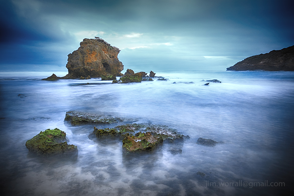
Eagles Nest is a popular rock formation and beach located on Victoria’s Bass Coast. It’s about half way between Inverloch and Cape Paterson, and it’s well sign posted.
Pictured below, a couple of long exposure images from Eagles Nest on a bright afternoon with patchy cloud. Conditions on the day were very photographically challenging as the sun was diffused by cloud one moment, then it would pop out with all it’s brutal harshness the next moment. This would happen several times during each long exposure causing many of my shots to be blown out. Thankfully not all. 🙂
Technical stuff for both images – 150 sec f/18 iso50 using an ND500 and ND8 filter.
Last weekend we had our ND group excursion for beginners. It was a great turnout with lots of enthusiastic people attending. We started shooting at Bridgewater Bay in Sorrento in very difficult conditions with the wind blowing a continuous mist of fine rain onto our lenses. I was both surprised and delighted that so many people stayed and had the patience to put up with these conditions, …..such a dedicated bunch. 🙂 Many thanks to Jason Cincotta and Michael Stringer for assisting with so many ND newcomers.
Later we moved onto the front beaches at Point King, Sorrento, followed by Shelley beach, Portsea , both providing us with much more friendly shooting conditions.
Pictured below – Point King jetty. Tech stuff – 132 secs f/18.
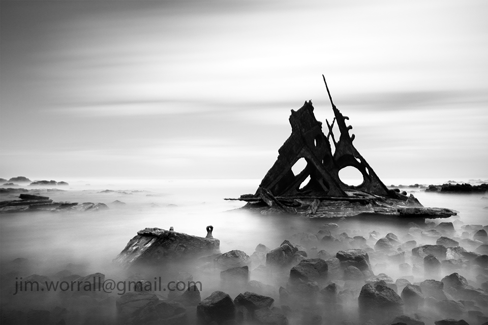
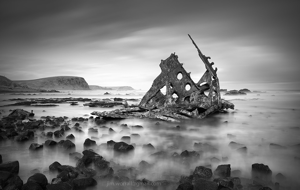
Following are a couple of long exposure images of the SS Speke shipwreck at Kitty Miller Bay on Phillip Island.
The first image was captured using an ND400 and two ND8 filters stacked together to achieve an exposure time of 195 seconds on a bright afternoon. Such a long exposure allows blurring of both the ocean waves and the moving clouds.
The image below is a 13 second exposure. This shorter exposure allows misting of the waves but leaves the moving clouds only slightly blurred.
Pictured below, a 10 second exposure of surf washing over the dark rocks at Kitty Miller Bay.
Below, a 2.5 second exposure of waves crashing onto the beach at Kitty Miller Bay.
Finally, a 0.8 second exposure of a large wave slamming into a rock on Kitty Miller beach.
If you’re new to long exposure photography using dark ND filters then you might like to check out this page for some tips to get you started.
Shack Bay and Eagles Nest are part of the Bunurong Marine Park located between Cape Paterson and Inverloch. Access to the beach is via stairs from the cliff tops.
Pictured below – A long exposure image from Shack Bay with the Eagles Nest rock formation in the background.
Pictured below – The view from the end of Eagles Nest looking out to sea.
Pictured below – Shack Bay looking back towards Eagles Nest.


 Above – Behind the scenes.
 Above – Behind the scenes.
 10 seconds, f/13, iso100.
 30 secs, f/18, iso 100.
 15 seconds, f/14, iso100.
 48 seconds, f/8, iso200.