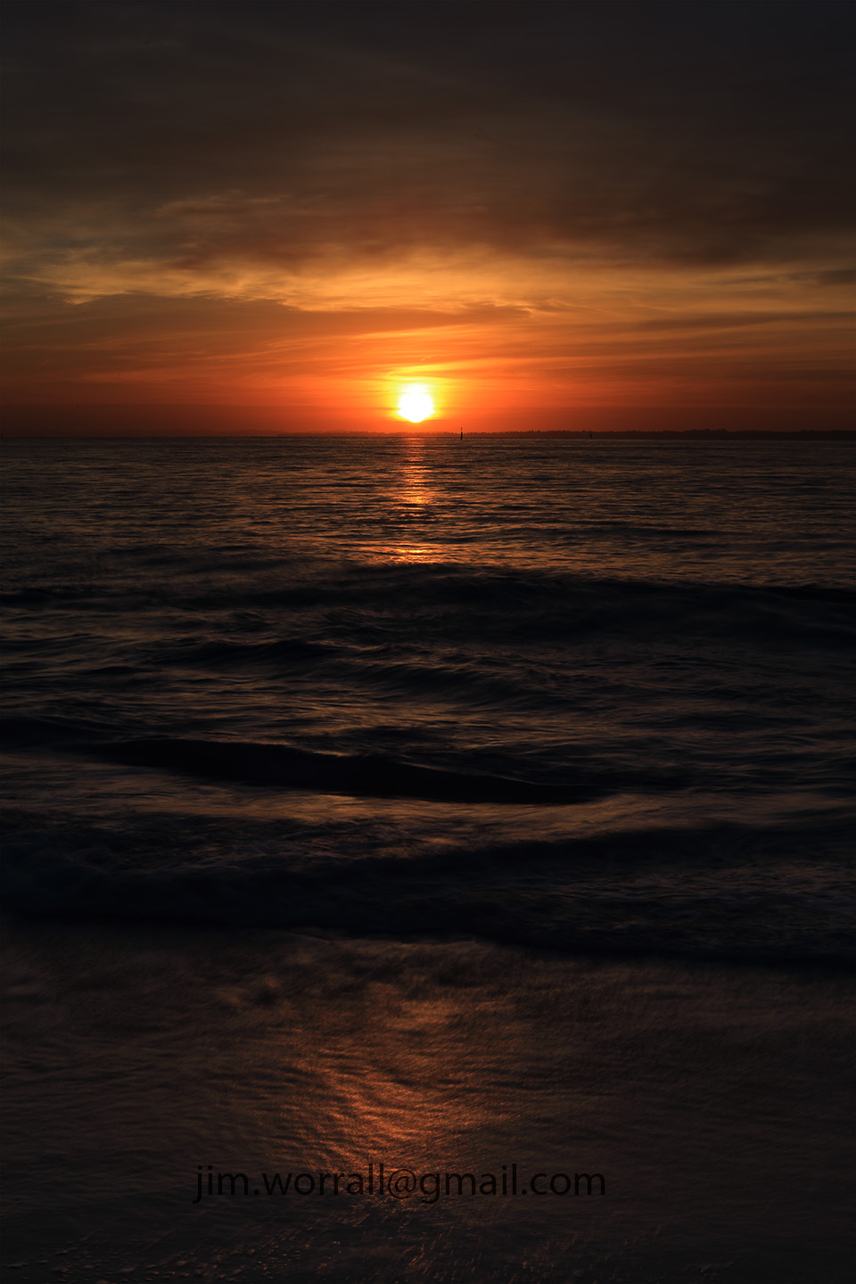
The setting sun at Tenby Point beach, Western Port Bay.
On this occasion the tide was so high that the water’s edge was all the way up to the vegetation line so there wasn’t much opportunity to explore the beach. We could only walk a few short metres to the left of the access stairs and no further.
Fortunately though it was still possible to catch a glimpse of the setting sun from this position.
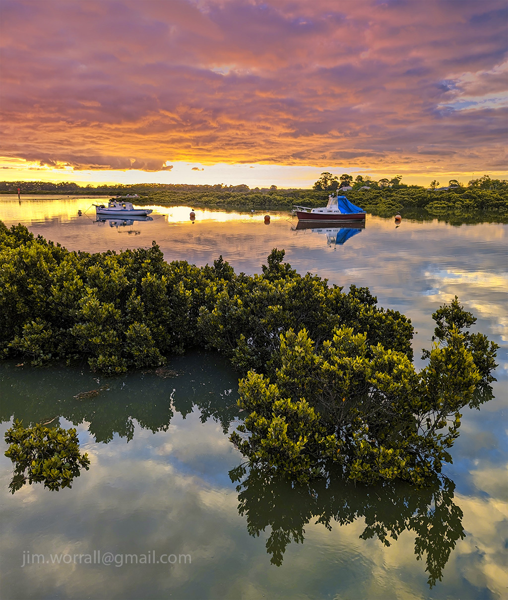
The French Island to Corinella Barge traverses a narrow section of Western Port Bay carrying vehicles and passengers back and forth between the island and mainland.
Pictured below is a long exposure image of the Corinella Barge landing area as sunset approaches.
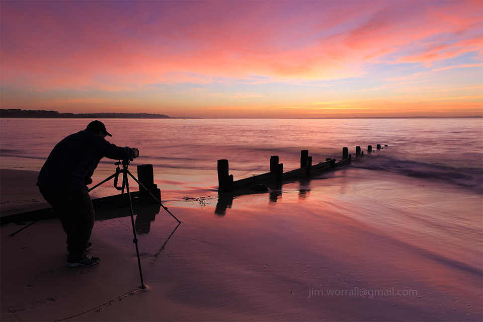
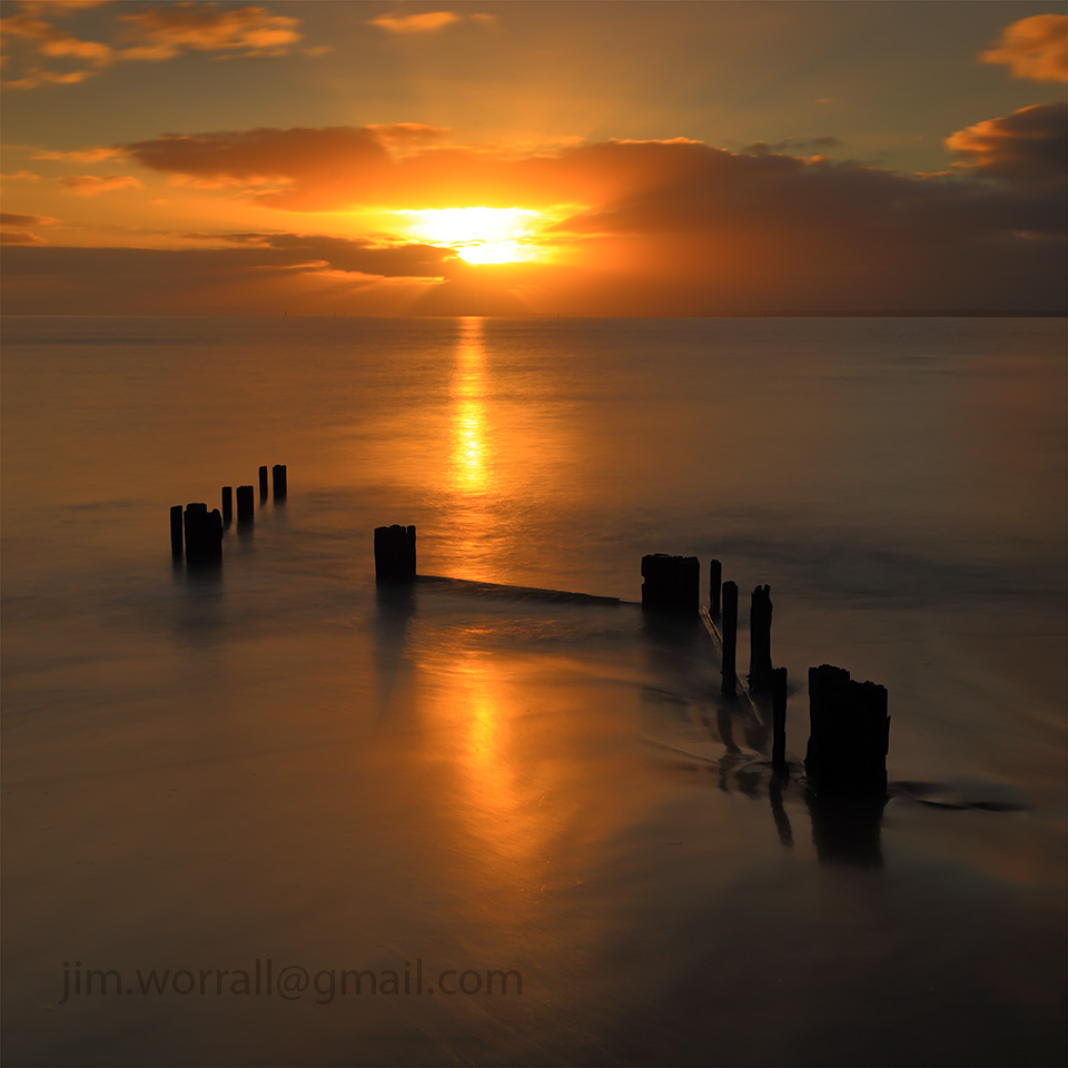
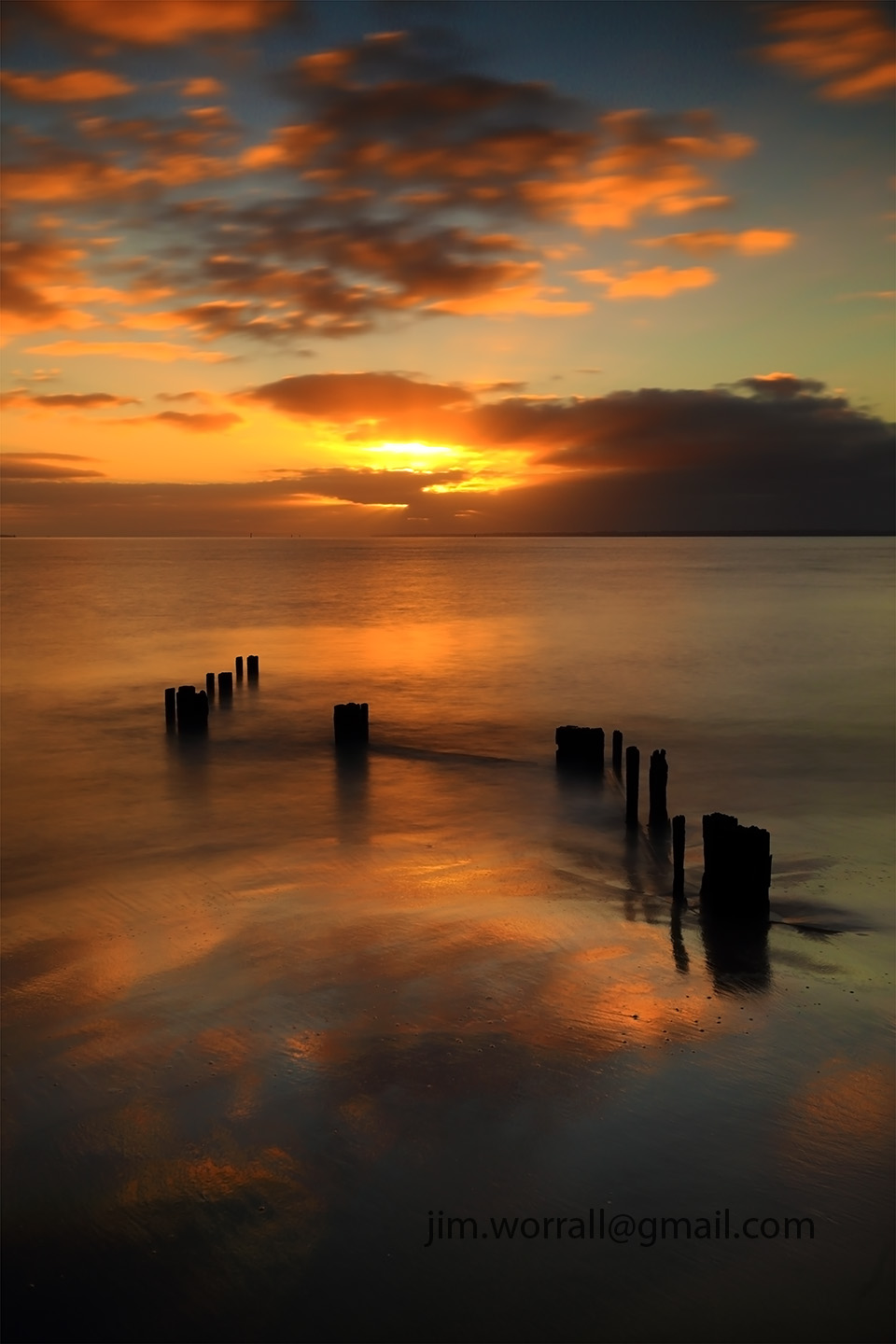
Another sunrise expedition to the groynes at Balnarring Beach on Western Port Bay. This time we visited the straight groynes on the beach near the general store.
The image above was shot just before the sun broke through the clouds on the horizon. It’s a 2 second exposure, slightly smoothing the surface details in the water.
Pictured above – A short exposure as the sun breaks through the clouds. I liked the way the reflected sun rays were glinting off the waves and the foreground sand.
Pictured above – As the sun rises higher in the sky, one of the groynes becomes beautifully side lit by the warming rays. This is a short exposure (1/20 sec f/18 iso100) shot with the camera way down low almost resting on the sand.
Pictured above – Friend Jason preparing for his next shot as the sky lights up.
A couple of dawn shots from the zig-zag groyne at Balnarring Beach on Western Port Bay.
Tech stuff – 10 secs, f/8, iso 100, using a 10 stop and 4 stop soft grad ND filter.
For those who might be interested in photographing the groyne, it’s easily accessible. Park at the end of Seawind Rd, Balnarring Beach. It’s a short walk down to the beach then turn right. There are also a few straight groynes off to the left.
Tech stuff – 13 secs, f/8, 10 stopper and 4 stop soft grad.
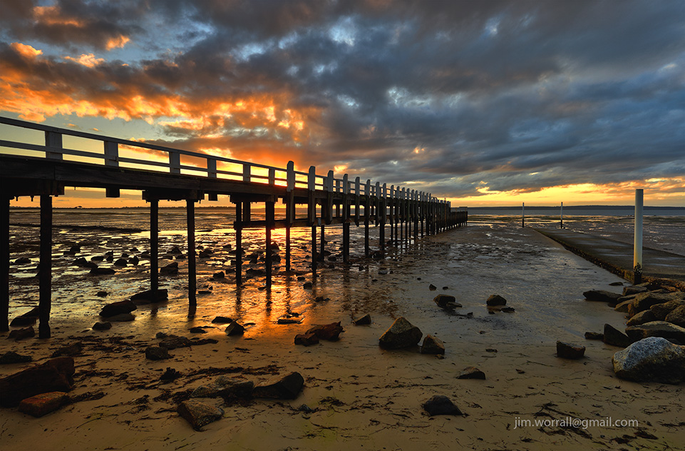
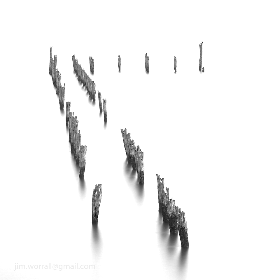
Tenby Point is a coastal village sitting on the eastern side of Western Port Bay, about half way between Grantville and Corinella. The jetty remnants are best visited near high tide when water surrounds the base of the posts. When the tide recedes here it goes WAY out leaving the posts sitting in an unattractive bed of mud.
Tech stuff for the image below – 260 secs at f/13, ND400 + ND8 filters.
Tech stuff for the image below – 205 secs at f/14, ND400 + ND8 filters.
For those unfamiliar with groynes, a groyne is a low wall or timber barrier built out into the sea from a beach to prevent erosion.
On a previous visit to photograph this groyne the tide was unexpectedly low and yielded images that weren’t quite what we were looking for. This time I made sure to arrive at peak high tide and waited for the tide to recede and reveal just enough of the groyne to catch these images.
A local resident told me that the zig-zagging planks aren’t always visible and that they’re sometimes completely covered by sand with only the posts exposed.
For those who might be interested in photographing the groyne, it’s easily accessible. Park at the end of Seawind Rd, Balnarring Beach. It’s a short walk down to the beach then turn right.
Tech stuff – 25 secs @ f/9 using a 10 stop solid + 4 stop soft ND grad + polarizer.
Tech stuff for the image below – 13 secs f/9, NiSi 10 stop solid + 4 stop soft grad + polarizer.
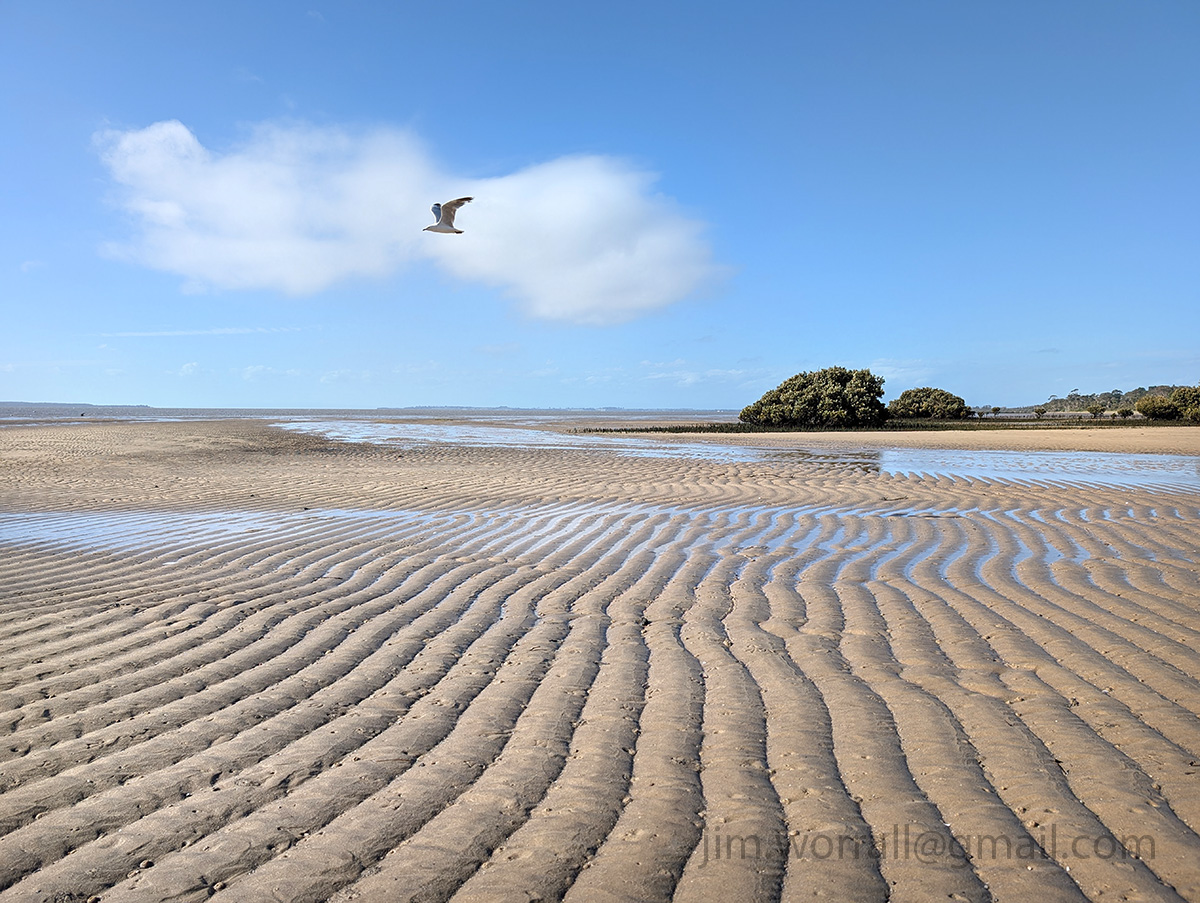
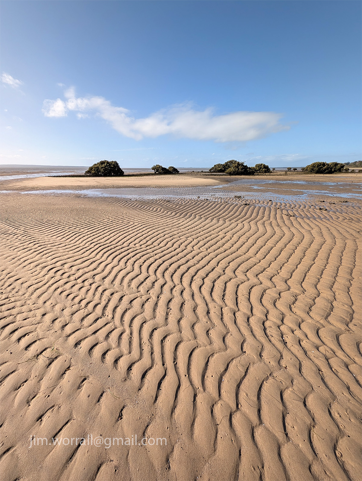
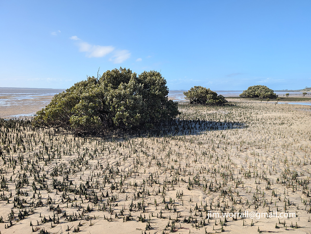
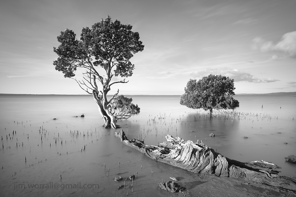
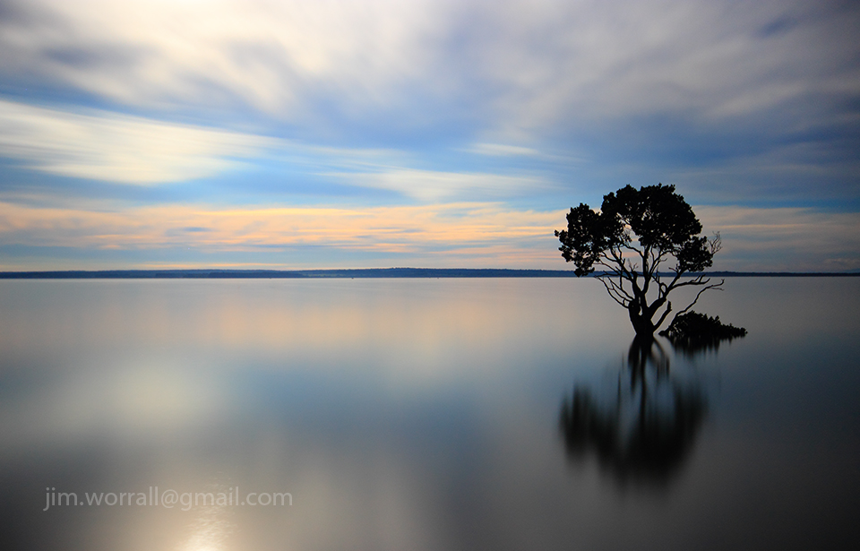
Ol’Woody is a popular mangrove tree at Tenby Point on Western Port Bay.
In this image the reflection in the water has been enhanced by smoothing the surface ripples using a 180 second exposure time made possible with dark ND filters.
The groynes at Balnarring Beach serve to reduce erosion at the water’s edge. Most of the groynes are simply a line of posts connected together by planks creating a straight sea wall.
I was struggling to find something interesting on the beach then stumbled across this baby zig-zagging out into the bay.
We had arrived just in time. The high tide was starting to recede giving us easy access to the beach yet there was still enough water covering the base of the jetty posts.
If you arrive at this destination at the wrong time you’ll find sticks in mud.
Below – Two images of the Tenby Point jetty remnants.
Pictured below – On the way back to the car park the water had receded enough to reveal the tangled root system on this Tenby Point icon.
The photography community seems to be polarized over the use of phone cameras and associated filter programs such as Instagram.
I must admit to being slow to travel down the “phone and filter” path and have only recently decided to give it a go to see what all the noise is about.
Since giving it a trial run I must admit that the use of Instagram and other similar programs has reintroduced a fresh and fun aspect to my photography.
Pictured below – Rye Pier.
I find it refreshingly simple to just pull out my phone, click, process and even publish the image so quickly.
I also enjoy being forced to rethink my compositions into a square format after being conditioned by years of using a 3×2 SLR format.
Pictured below – A foggy morning at Tooradin foreshore.
Admittedly I’ve had to resist the urge to “pixel peep” at the noise and visual anomalies created by some of the clunky filters.
This will never replace my SLR photography but I reckon it will complement it nicely. Phone photography has definitely introduced a fresh fun aspect to my photo life.
Following are a series of images from Queensferry, on Western Port Bay, demonstrating the area’s vast difference in appearance between high tide and low tide. The high tide images were taken using my 40D with heavy ND filtering.
The low tide images were captured a week earlier (as reference photos) using my phone camera and post processed using an Android app called Retro Camera.
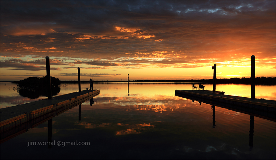
A high tide view of the docking station at Corinella. This is where the French Island barge docks to transfer vehicles and passengers to and from the mainland.
Below – Old Man of the Sea, an old mangrove tree just a stone’s throw away from the docking station.
There’s something quite magical about Tenby Point. It’s one of those areas I feel compelled to visit from time to time.
A great surprise this visit was to find the road is now surfaced with asphalt. I’m going to miss all the corrugations and pot holes that once adorned the old dirt track leading to the beach.
Tooradin is right at the top of my list when it comes to escaping for a little bit of quiet time. Located just a few minutes down the road from my home, Tooradin’s features include a serene creek that runs through the town and winds it’s way down to a great foreshore area where it joins with Westernport Bay.
The foreshore area usually has lots of parking spaces available and serves as a fine place to devour whatever delicacy you’ve chosen from the local bakery, fish and chip, or pizza shop.
Alternatively you can bring along your own boring food and make use of the BBQs.
Pictured below – The view looking down the channel towards Westernport Bay at low tide.
During low tide, large expanses of mud are exposed along both sides of the channel.
You can stroll along the elevated edge of the channel and watch as thousands of tiny crabs, disturbed by your presence, dive for cover into their tiny holes in the mud.
Pictured below – The view looking up the channel towards the main road.
Back to the serious topic of food for a moment, I highly recommend the Tooradin bakery with it’s fine selection of meat pies. They also have more sweet cake/bun/doughnut thingies than you could poke a stick at, …..and the coffee isn’t too bad there either.
The bakery is also conveniently located next to the fine Ice Cream shop, offering heaps of different flavours for those craving even more sugar. 😉
Fish n’chips must be big business in Tooradin because this tiny town has no less than two fish n chip shops.
On one side of the main road is the Tooradin Original Fish & Chip Shop and across the road is the Boardwalk Chippery. The Boardwalk shop boasts the use of “healthy rice bran oil”. The rice bran oil must be an acquired taste, …I’ve tried it but I haven’t yet acquired that particular taste,….but each to their own.
Pictured below – Down the channel a short distance, remnants of the old jetty pictured at high tide, complete with “god rays” shooting through the clouds signaling the end of a beautiful day.
Below – The same jetty remnants pictured at low tide, complete with an amazing number of mud dwelling crabs and their mud holes. 🙂
For the curious photographers who might be reading this post, the camera I used was a Panasonic Lumix LX3 in “dynamic B&W” mode with some minor corrections later in Photoshop.
If you’re interested in using any of these images or would like to purchase a high quality print then please contact me at – jim.worrall@gmail.com
Following on from previous posts I thought I’d share with you just a few more images from the Phillip Island coastline. I feel like I’ve just scratched the surface down there, …….there’s just so much beauty to explore and discover.
Pictured below – The Roost – old jetty remnants that serve as a safe roost for the local birds at Cat Bay.
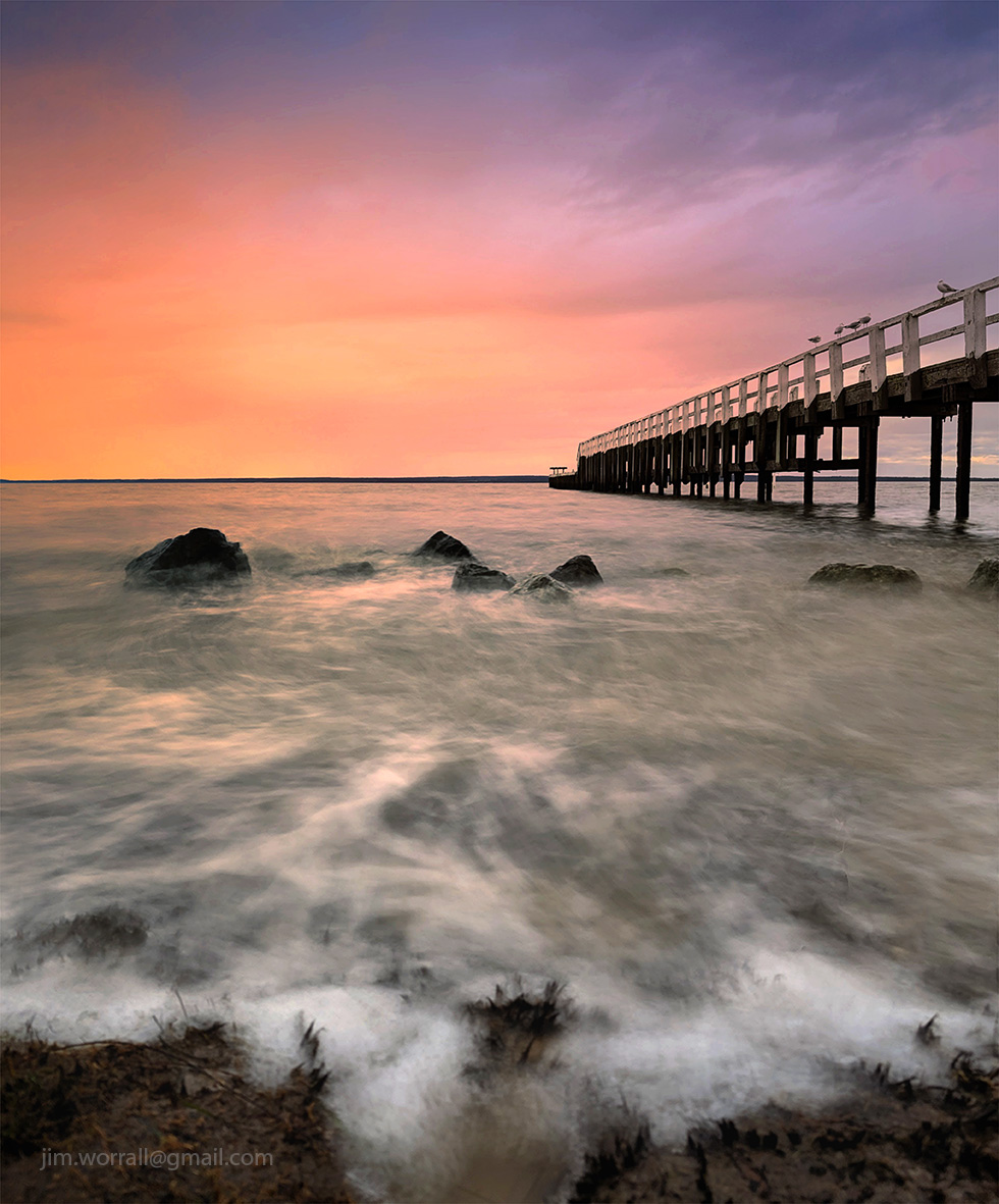
Pictured below – Evidence of Life – a soft misty view of some wonderful wave action off Cowrie beach.
Pictured below – The Long Swim Home – another view from Cowrie beach looking towards the Nobbies in the background.
Pictured below – Pyramid Rock, taken in strong windy and wet conditions from a vantage point ahead of the lookout area.